
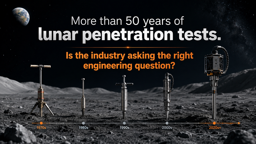
Lunar GIMP: Implementing Geotechnical Control on Construction Sites on the Moon
- Apr 18
- 13 min read
From site uncertainty to operational control: instrumentation as the governing system for excavation, trafficability, and foundation performance
A Geotechnical Instrumentation and Monitoring Plan on the Moon is not a supporting document. It is the system that governs whether construction proceeds, pauses, or fails.
On Earth, a GIMP typically verifies design assumptions during excavation, shaft sinking, tunneling, slope stabilization, or foundation works. The ground is investigated, parameters are selected, and instrumentation confirms whether behavior remains within expected bounds. On the Moon, that sequence does not hold. There is no continuous subsurface investigation grid, no contractor experience in comparable ground, and no tolerance for iterative correction once operations begin. The ground must be interpreted and controlled in parallel with construction.

Lunar regolith is not a uniform deposit. It is a layered, mechanically evolving granular system, with strength, stiffness, and density varying with depth and local context. Apollo observations and measurements already showed that density and strength increase with depth, and that near-surface behavior can change over meter-scale distances, particularly across crater rims, slopes, and intercrater plains. Chang’e-6 confirms this variability structurally, identifying distinct shallow layering within the first meters, with a weathered upper unit overlying more competent material. These are not academic observations. They directly control settlement, trafficability, excavation response, and load transfer.
Construction on the Moon will take place in this environment, under low confinement, extreme thermal cycling, and continuous dust mobilization. Every excavation cut, every rover pass, every landing interface, and every foundation load will interact with a ground that is only partially known at the time of execution. In this context, a GIMP must do more than monitor. It must define the acceptable ground response in real time and trigger decisions.
This shifts the role of instrumentation from passive verification to active control. Measurements are not collected to build a dataset; they are collected to determine whether a pad is stable enough to receive a lander, whether a haul route is degrading beyond acceptable limits, whether an excavation face is relaxing, or whether a foundation is undergoing differential settlement outside operational tolerances.
The implementation of a lunar GIMP therefore starts before construction and continues through all phases of site preparation and operation. It is embedded in terrain characterization, trial works, excavation sequencing, compaction targets, traffic management, and long-term asset performance. It defines thresholds, not just trends. It connects sensors directly to actions.
Without this structure, construction becomes an uncontrolled interaction with the ground. With it, the site becomes manageable, even under uncertainty.
All monitored responses must be interpreted against defined load cases. These include static loads from structures, cyclic loads from rover traffic, dynamic loads from landing and ascent plume interaction, and thermal loading cycles. Without this linkage, measurements cannot be translated into design or operational decisions.
Why the Terrestrial GIMP Model Is Not Enough
On Earth, a GIMP is built around confirmation. We define a ground model, assign parameters, design the system, and use instrumentation to verify deformation around shafts, tunnels, slopes, retaining systems, and foundations. The objective is control within a known envelope.
On the Moon, there is no such envelope.
Ground conditions are not defined to construction standards. The regolith behaves as a low-confinement granular system, where stress levels are minimal, fabric effects dominate, and small disturbances can produce disproportionate response. Strength and stiffness are not governed by overburden in the classical sense, but by stress history, particle interlock, and local state. That alone breaks the terrestrial assumption that depth equals predictability.
Add to this the environment. Thermal cycling is not a secondary effect; it drives expansion, contraction, and progressive degradation at interfaces. Plume impingement during landing and ascent reworks the surface locally, altering density, roughness, and particle distribution. Dust is not just a nuisance; it is a mobile, electrostatically active fraction that affects both surface conditions and instrumentation reliability. None of these are marginal factors. They are primary drivers of ground behavior.
There is also no tolerance for corrective construction. On Earth, if a foundation settles beyond expectation or a slope shows distress, mitigation can be implemented. On the Moon, intervention is limited, delayed, and expensive. That shifts the focus from reaction to control.
This is where the terrestrial GIMP model fails. It assumes that monitoring is there to confirm performance against a reasonably accurate design basis. On the Moon, monitoring must define the design basis as construction progresses.
The governing limit state also changes. Ultimate failure is not the primary concern for most early lunar infrastructure. Serviceability controls the system. Settlement, stiffness, and deformation compatibility govern landing interfaces, equipment alignment, mobility corridors, and structural connections. Apollo observations already pointed in this direction: the surface behaved within bearing limits, but local variability in density, strength, and deformation response was evident and directly influenced mobility and interaction with the ground.
What would be the difference between them?
A terrestrial GIMP verifies.
A lunar GIMP defines, controls, and constrains.
The Lunar GIMP Starts Before Construction Starts
Implementation does not begin with mobilization. It begins at site investigation.
On the Moon, the first role of the GIMP is to convert orbital interpretation into construction intelligence that can be trusted at the meter scale. Orbital data defines context. It does not define behavior. The gap between the two is where most of the risk sits.
This is where the GIMP is first deployed.
Terrain roughness is not just mapped; it is verified against actual mobility response. Slopes are not accepted from digital models; they are confirmed through rover interaction and localized measurement. Shallow subsurface conditions are not inferred from remote sensing alone; they are resolved through direct probing, penetration resistance, and geophysical profiling. The objective is not to describe the site. The objective is to establish how the ground will respond when disturbed.
This stage defines the initial ground state. It identifies where the regolith behaves as a loose surface layer, where it transitions to a more competent state, and where variability is high enough to control construction sequencing. It also defines where dust-prone zones exist, where weakly compacted layers may govern trafficability, and where local heterogeneities will influence excavation and support.
The GIMP captures this baseline through direct measurement. It establishes reference values for deformation, penetration, and mobility response before any construction activity modifies the ground. Without this step, there is no reference against which to interpret change.
This is also where early trafficability checks and trial disturbances are introduced. Controlled rover passes, localized excavation, and small-scale compaction tests are used to observe how the ground evolves under load. These are not trials in the conventional sense. They are calibration steps for the entire construction program.
From this point forward, all construction is measured against this baseline. Any deviation is interpreted as ground response, not as noise.
What the Lunar GIMP Must Monitor
The monitoring framework needs to be explicitly anchored in what has already been observed in situ: rapid spatial variability, shallow layering, and state-dependent mechanical response. Apollo did not suggest uniform ground. It demonstrated the opposite through penetration resistance, core tubes, and wheel–soil interaction. Chang’e-6 reinforces this with stratified radar signatures within the first meters. That evidence must drive what is monitored.
A lunar GIMP therefore tracks state transitions, not just responses.
Ground response must be resolved at the scale where Apollo already showed variability. Settlement is not a single value. It is a spatial field that changes over meters and even sub-meter scale depending on local fabric and disturbance. Penetrometer data from Apollo 15/16/17 showed significant variation in resistance over short distances, reflecting changes in density and structure. Monitoring must therefore capture differential settlement, not just global trends. Rutting and bearing degradation are localized phenomena controlled by near-surface state changes in L1–L2. The system must detect where the ground is yielding, not assume uniform performance across the working area.

Mobility response is directly tied to the Apollo wheel–soil interaction results. Sinkage and slip were not constant; they varied with terrain type, slope position, and regolith condition. Repeated loading altered the surface rapidly. Monitoring must track progressive degradation of haul routes, not initial performance. Trafficability is a time-dependent function of disturbance. The GIMP must capture how the surface evolves under cyclic loading, particularly at transitions such as crater rims and intercrater plains where lateral variability is expected.
Subsurface response is non-negotiable given Chang’e-6 results. The first few meters are layered, with distinct mechanical contrasts. These layers control load transfer and excavation behavior. Monitoring must resolve stiffness and resistance changes with depth, not rely on averaged properties. Apollo core tubes already indicated density increase with depth but with discontinuities. Chang’e radar confirms that layering is systematic, not incidental. Instrumentation must therefore detect transitions, not just trends. Excavation response, tool resistance, and penetration feedback become indirect but critical indicators of subsurface state.
Environmental response must be treated as a driver of mechanical evolution. Thermal cycling induces repeated expansion and contraction of the regolith matrix, affecting contact behavior and stiffness. Dust redistribution modifies the surface layer continuously, altering mobility and load response. Apollo observations of surface disturbance and dust adhesion demonstrate that the ground condition is not static. Monitoring must capture these cumulative effects as they directly influence performance over time.
Structural interface response must be interpreted through this variability framework. Tilt and differential settlement are expected outcomes when structures interact with a non-uniform ground. Apollo LM experiences already showed sensitivity to local ground conditions. Monitoring must resolve differential movements at support points, not just total displacement. Load redistribution is driven by heterogeneity in stiffness and strength, particularly across shallow layers.
Construction process response must also be tracked. Excavation energy, penetration rate, cutting resistance, and material handling behavior provide continuous feedback on ground state. Variations in tool response often identify changes in density, fabric, or layering before they are visible in deformation measurements. These parameters are not indirect; they are primary indicators during active works.
The key correction is this: the GIMP cannot assume a representative ground profile. There is no representative profile at the operational scale.
It must instead detect and track where and how the ground departs from uniformity, because that is the baseline condition already demonstrated on the Moon.
Instrumentation Strategy Under Lunar Constraints
Instrumentation on the Moon is not a scaled version of terrestrial practice. The constraint set, vacuum, 1/6g confinement, thermal cycling, dust intrusion, and logistics, fundamentally changes how measurements are obtained and, more importantly, how they are interpreted. The objective is not to replicate a full terrestrial GIMP. It is to deploy a minimal, high-reliability system that captures ground state evolution with defensible resolution.
The first principle is that instrumentation must be state-sensitive, not just response-based. Given the very low in-situ effective stress, small disturbances induce disproportionately large changes in behavior. What would be second-order noise on Earth becomes first-order signal on the Moon. This is consistent with Apollo penetrometer data, where resistance changes reflected subtle variations in fabric rather than overburden-driven confinement.
Near-surface instrumentation (L1–L2, 0–1.5 m) is the priority zone. This is where mobility, initial bearing response, and excavation initiation are governed. Instrumentation must be shallow, distributed, and redundant. High-resolution displacement markers or embedded reference points can track localized settlement and rut development. These are not traditional survey points; they must resolve millimeter-scale changes across short spacing because differential behavior dominates. Apollo surface disturbance observations showed that even minor loading reorganizes the top layer rapidly.
Penetration-based measurements become the backbone of subsurface characterization. A CPT analogue, or staged penetration system integrated with construction equipment, provides continuous resistance profiling. The interpretation, however, must be normalized to the lunar stress regime. The signal is not strength in the classical sense; proxy for regolith state, interpreted through OCR* as a stress-history descriptor under lunar conditions. This aligns with Apollo soil mechanics experiments where penetration resistance was one of the few consistent indicators of variability. Instrumentation should therefore prioritize repeatable penetration measurements at key locations to track evolution of the ground with time and disturbance.
Structural interface monitoring must be simplified but precise. Tiltmeters and localized displacement sensors at support interfaces provide direct indication of differential settlement and load redistribution. Given the expected heterogeneity, global measurements are insufficient. The system must detect rotation and relative movement between supports. Apollo LM performance already indicated that local ground conditions control stability more than global assumptions.

Thermal and environmental sensing is not auxiliary—it is integral. Temperature gradients through the regolith influence stiffness and interparticle forces. Sensors must be embedded within the shallow profile to capture diurnal cycling. Surface measurements alone are inadequate. Dust deposition and redistribution should be tracked indirectly through performance degradation metrics, as direct measurement is difficult under operational constraints.
Data acquisition architecture must be robust and low maintenance. Wiring, connectors, and exposed components are vulnerable to dust and thermal fatigue. Wireless or semi-autonomous systems with minimal physical interfaces are preferred. Redundancy is essential, but not through duplication of complex systems, rather through multiple simple sensors providing overlapping insight. The design philosophy is closer to mining operations in harsh environments than to controlled civil sites.
Integration with construction equipment is a critical shift from terrestrial practice. Instrumentation should not be isolated from operations. Excavators, drills, and mobility systems become measurement platforms. Tool resistance, penetration rate, and energy input provide continuous feedback on ground conditions. This is consistent with how ground is effectively “instrumented” in underground construction on Earth, but here it becomes primary rather than supplementary.
The governing constraint is logistics: every sensor must justify its mass, power, and deployment complexity. Therefore, the instrumentation strategy must converge toward a lean system focused on capturing ground state transitions, not an exhaustive measurement network.
Instrument deployment must also consider emplacement feasibility. Drilling, anchoring, and sensor installation in low confinement regolith require controlled disturbance. Instrumentation that cannot be reliably installed without altering the measured ground condition introduces bias. This must be accounted for in both design and interpretation.
The key position is clear:
A lunar GIMP is not defined by the number of instruments deployed, but by its ability to resolve the evolution of the regolith state under loading, disturbance, and environmental cycling.
Suggested Trigger Philosophy
A lunar GIMP must operate on thresholds that are actionable, not theoretical. Precision for its own sake has no value. The objective is to define when construction continues, when it is constrained, and when it stops.
The trigger system therefore needs to be simple, transparent, and directly tied to ground performance.
Three levels are sufficient and necessary.
Review level marks the first deviation from the expected trend. This is not an alarm. It is an indication that the ground is responding differently than assumed. At this stage, the focus is on verification. Data is checked for consistency, spatial patterns are examined, and the deviation is interpreted against construction activities. For example, a localized increase in settlement rate or an unexpected increase in wheel sinkage under repeated passes would trigger a review. Construction can continue, but with attention and confirmation.
Alert level introduces operational constraint. The deviation is no longer marginal. The ground is transitioning toward a condition that may compromise performance if left unmanaged. At this stage, construction activities are modified. Traffic may be reduced or rerouted. Compaction effort may be increased or redefined. Excavation geometry may be adjusted. The objective is to prevent progression into an unstable or unacceptable state. The key point is that the system reacts before loss of control, not after.
Action level is a stop condition. The ground has reached a state where continued operation cannot be justified. This is not limited to ultimate failure. Serviceability governs most lunar systems. Excessive differential settlement, unacceptable tilt, progressive rutting, or loss of bearing response at a landing interface are sufficient to trigger this level. At this point, construction stops, the condition is reassessed, and either redesign, rework, or relocation is implemented.
The thresholds between these levels must be defined in terms of measurable behavior, not inferred properties. Settlement magnitude and rate, including acceleration of deformation, differential movement, penetration resistance trends, sinkage progression, and tilt are all valid parameters. What matters is that each threshold is linked to a decision.
There is no benefit in defining narrow tolerances that cannot be enforced operationally. The system must reflect what can actually be measured and acted upon under lunar conditions.
The critical aspect is consistency. Once thresholds are defined, they must be applied without exception. A GIMP that allows interpretation to drift under operational pressure loses its function.
Implementation in Phases
Phase 1 – Baseline establishment
Define the undisturbed condition. Terrain, shallow response, initial penetration resistance, and mobility behavior are recorded before any systematic disturbance. This is the reference state. Without it, no deviation can be quantified.
Phase 2 – Trial section and calibration area
A controlled working zone is established. Excavation tools, compaction methods, rover loading, and monitoring response are calibrated against actual regolith behavior. This is where assumptions are adjusted before full deployment. It is the only safe place to learn.
Phase 3 – Active construction monitoring
During grading, excavation, pad formation, and hauling, monitoring is continuous and tied to decisions. Settlement, rutting, penetration trends, and mobility response are evaluated in real time. Stop work, hold points, and redesign triggers are enforced here. This is the operational core of the GIMP. Monitoring must maintain sufficient spatial coverage to capture localized failure mechanisms. Point measurements are not sufficient where variability is expected at meter scale.
Phase 4 – Operational verification
After construction, a reduced monitoring network remains. The objective is to track long-term settlement, thermal effects, dust-driven surface evolution, and performance under repeated operations. This phase protects assets, not just construction.
The Apollo Lessons
Apollo did not deploy a formal GIMP, but it established the operating principle: ground behavior must be inferred from direct interaction and continuously interpreted during operations.
There was no predefined monitoring network. Instead, the ground was effectively “instrumented” through multiple channels, penetration resistance, core recovery, rover mobility, excavation effort, geophone arrays, gravimeter readings, and systematic visual documentation. Each of these provided partial insight into the state of the regolith. Together, they provided a distributed interpretation of ground conditions during operations.
The key observation is not the data itself. It is how the data was obtained.
Every meaningful parameter came from interaction with the ground.
Penetrometer measurements showed variability in resistance that could not be explained by depth alone. Core tubes revealed density increase with depth but also discontinuities and local variation. Rover operations demonstrated that mobility response changed with terrain type, slope position, and repeated loading. Drill performance varied depending on local conditions, indicating changes in stiffness and structure. Geophysical experiments provided additional context on subsurface response and continuity.
This was not a controlled monitoring system, but it exposed the fundamental condition: the lunar surface is heterogeneous, shallow behavior governs performance, and response evolves with disturbance.
The limitation is equally clear. All of this information was interpreted after the fact or during operations without a structured decision framework. There were no predefined thresholds, no trigger levels, and no integration between measurement and construction action because there was no construction program in the terrestrial sense.
A permanent lunar construction site cannot operate this way.
The lesson is not to replicate Apollo instrumentation. It is to formalize what Apollo revealed. Measurements must be planned, distributed, and directly tied to decisions. Interaction with the ground must be intentional, not incidental. Variability must be expected and tracked, not discovered during operations.
Final Position
The implementation of a Geotechnical Instrumentation and Monitoring Plan for lunar construction cannot be treated as an optional extension of design practice. It must be recognized as a core component of the engineering system, governing how uncertainty in ground conditions is managed from first contact through full operational deployment.
A lunar GIMP must therefore be built on three non-negotiable pillars:
Prediction before measurement
Instrumentation cannot be deployed generically. It must be driven by explicit hypotheses regarding regolith response, settlement, shear resistance, trafficability, and excavation performance. Without a predicted behavior envelope, monitoring has no engineering meaning.
Measurement of governing variables only
The focus must remain on parameters that directly control performance: deformation, stress transfer, penetration resistance, and structural response. The objective is not characterization for its own sake, but verification of system behavior under load.
Decision-linked monitoring
Data acquisition alone has no value. Each measurement must be tied to predefined thresholds, triggering operational responses such as load redistribution, traffic restriction, excavation adjustment, or redesign. This establishes a closed-loop system:
prediction → measurement → interpretation → action
From a construction standpoint, this shifts the paradigm from “design and execute” to “design, verify, and adapt.”
In the lunar context, this is not simply good practice, it is a requirement for feasibility. The combination of low confinement, highly variable regolith fabric, and absence of prior field validation means that no design can be considered reliable without embedded feedback mechanisms.
The implication is clear:
A landing pad, haul road, excavation, or foundation system without a GIMP is not a complete engineering system.
It is an assumption.
Ultimately, the role of GIMP in lunar construction is to provide the first true ground truth under operational conditions, transforming isolated measurements into engineering knowledge. This is the mechanism through which early missions evolve from demonstration to repeatable infrastructure delivery.
In practical terms, the success of lunar construction will not be determined by how well we model the ground before arrival, but by how effectively we measure and respond to it once operations begin.
Roberto de Moraes
Author | SpaceGeotech Founder

Comments